You CAN get there from here, and Langley hopes snappier road signs will help point the way.
A major revision of the South End’s highway and street signage is ready to roll after a two-year community effort.
“It’ll accomplish many things and draw more people into Langley,” Mayor Paul Samuelson predicted Thursday. “We’re grateful how it all worked out.”
The project, dubbed the Langley Sign Initiative, is a collaboration between South End communities (particularly Langley), Island County officials and the Washington State Department of Transportation.
In Langley, there was dogged participation by city officials, merchants, the Langley Chamber of Commerce and others in the community weary of being bypassed by the motoring public.
The focus is on more signs, more information on those signs and more strategic placement of signs pointing to highlights off the island’s Highway 525 main drag.
Samuelson said the total cost of the project is expected to be about $40,000. That includes a promised $30,000 federal grant routed through the state Department of Transportation, $5,000 from the Port of South Whidbey and the remainder from the city’s $18,000 budget to promote tourism.
Installation of the new and improved signage is expected to begin by mid-May, said Donna Keeler, Island County transportation planner.
“It’ll be a great benefit to Langley,” Keeler said.
Main features of the project include more prominent indications along both directions of the highway of the approaching communities of Freeland, Langley and Clinton.
The eastbound sign “Langley 4” approaching Bayview Road, for example, will be replaced by a larger one reading “Langley 4 miles” and including a “County Fairgrounds” sub-sign and three icons indicating dining, overnight accommodations and the Langley marina.
A new sign at Clinton indicating the distances to Langley, Freeland and the Port Townsend ferry will be erected, along with one in the other direction at Freeland indicating the distance to Langley, Clinton and the Mukilteo ferry.
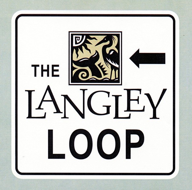
A prominent aspect of the project will be the creation of “The Langley Loop,” designed to guide motorists near the businesses in Bayview, which is within the Langley post code, through downtown Langley and out Langley Road to Ken’s Korner and the highway.
Sixteen signs inside the Langley city limits — most on or near Second Street — and four in both directions along Langley and Bayview roads will mark the loop.
The Langley signs at Maxwelton Road will be replaced by “South Whidbey Schools” signs to reduce the amount of Langley traffic through slow-speed areas near school buildings. Another change will include removing the sign pointing to the county fairgrounds that’s near Maxwelton Road; fairgrounds traffic will be directed down Bayview Road and through Langley instead.
Merchants will also be encouraged to take advantage of blue state highway signs that list the names of businesses and services offered.
Meanwhile, a major feature of the new sign program is a decorative “Historic Downtown Langley” sign with an artistic depiction of First Street and decorative metal work by Langley artist Tim Leonard.
That sign will be placed just south of Surface Road near the entrance to Ken’s Korner, directing motorists to turn right at Langley Road.
Sherry Jennings, chamber of commerce director, said the South End’s collaborative effort paid off in gaining “unwavering” state support for the project.
“We had our ducks in a row,” she said. “They saw we had a unified vision.”
“It seems like forever,” she added of the effort, “but we’re in the home stretch.”
“I can’t wait to see it in place,” Joanne Lechner, owner of the Eagle’s Nest Inn bed-and-breakfast on Saratoga Road just past the Langley city limits, said of the new signage.
Lechner was an early collaborator with the mayor to improve road markings on the South End.
A visitor and resident of the island for 25 years, she said concise directions to island attractions off the highway have always been a problem for tourists and residents alike.
“It’s been in need of updating for as long as I’ve been here,” Lechner said.
Kim Tiller, owner of Whidbey Island Soap Company in downtown Langley, has pushed for better signage for more than a year.
“Many, many people driving up and down the island aren’t aware of the fact that Langley’s here,” she said. “I hope this will coax people off the highway.”
“We need it,” she added. “A lot of businesses are on the edge right now.”
Samuelson joked that instead of directing tourists in and out of town, the Langley Loop should be configured to “get them stuck here for three or four nights.”
That might happen anyway, he added.
“Once they see what Langley has to offer, it will cause them to stay,” he said.
Next week, Experience Langley will offer a program about the Langley Sign Initiative, featuring city, county and state officials and several community members.
Information about how merchants can be listed on blue state highway services signs will be covered.
The program will be at 9:30 a.m. Tuesday, April 5, at the Clyde Theatre on First Street downtown. For information, call the Langley Chamber of Commerce at 221-6765.


