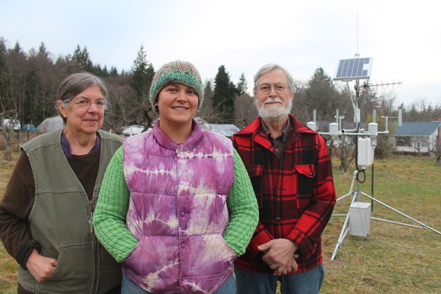
The sheep on John and Molly Petersons’ farm trot along the small apple and pear orchard, completely unaware of how the ground temperature and moisture may affect their next meal.
John and Molly Petersons know exactly the importance of accurate and reliable weather readings. That’s why when the Washington State University Island County Extension called about using some of their 5-acre property to install a new station as part of WSU AgWeatherNet, they were happy to host the device that looks like it belongs more on the USS Enterprise than on a farm.
“It does look like it just landed,” said Molly Petersons.
The Langley station is the first of its kind on South Whidbey, and only the third on the entire island. One weather station owned by the Navy is at NAS Whidbey Island in Oak Harbor, and one WSU station is on Ebey’s Prairie in Coupeville. As South Whidbey residents have long known, the weather differs drastically along the 40-mile island.
“We all know the weather on South Whidbey can be complex,” said Barbara Bennett, Island County Extension program coordinator. “We also know that stormwater runoff issues, personal maintenance of property … all of that will benefit from more accurate information.”
“We have microclimates all over the island,” she added. “Whether they’re hobby farmers or full-on farmers, it helps them.” 
Ground temperatures from the Petersons’ farm, which according to the station’s online readings is at 166 feet of elevation, will dictate how and when farmers plant crops. Molly Petersons noted the delicacy of planting ginger, which prefers temperatures at 50 degrees and rising in her hoop house, or else she’ll lose an entire crop.
With the convenience of Internet access and even a smartphone app, the Petersons and other South Whidbey growers can check detailed information from their hyperlocal weather station.
“We don’t have to even look out the window to see what the weather’s like anymore,” John Petersons said. “We can just pull up the web site.”
Online at weather.wsu.edu/awn.php, a map pops up with the 158 station sites, four of which are in Oregon. Each station gives the air temperature, humidity, dewpoint, wind speed, rainfall, solar radiation, soil temperature, leaf wetness, longitude, elevation and its date of installation.
The Craw Road location was selected because of its seclusion from general traffic, openness to the elements and removal from possible danger. Having a wind speed gauge blocked by trees or buildings wouldn’t make much sense, Bennett said.
WSU AgWeatherNet Director Gerrit Hoogenboom said they tried for at least three years to find the means and location for a station on South Whidbey. Island County Extension sought space with the South Whidbey Parks & Recreation District, but found that securing the station from vandalism or damage was too difficult.
“The soccer balls might have presented a problem,” Bennett said.
Installing a new station cost $10,000, which is generated entirely from within the community of each device. Maintenance to service the station after the first year costs $1,500 per year. That cost, Bennett said, would likely be covered by fundraising campaigns organized by the Island County Extension.
“It takes some money to do this,” Bennett said.
With the money in hand, the extension found the Petersons to be willing partners. Molly Petersons’ father, Robert K. Fankhauser, was a career meteorologist and she has fond memories reading barometers and reading wind speeds with him as a child. They plan to add a plaque in his honor to the station, an idea supported by Bennett and AgWeatherNet’s director.
“Finding a location for this weather station has been a real challenge,” Hoogbenboom said. “Now we’ve found the perfect hosts.”


